Back
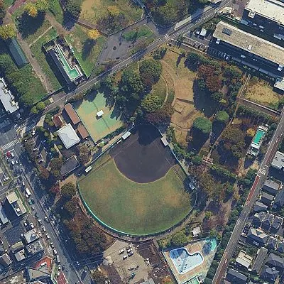
卡通无人机视角谷歌地图插画Click for full size · wheel to zoom · drag to pan
PromptImageNano Banana Pro

卡通无人机视角谷歌地图插画

Cartoon drone-style Google Maps aerial illustration prompt

A prompt that converts Google Maps or Google Earth aerial screenshots into vibrant, whimsical cartoon-style drone photographs with tiny figures and magazine-quality illustration.

Social Media Postsocial-media-postneeds-reference
0
0
Author: YouMind Community
Remix in Studio
中文· 首次访问自动生成译文…
English

Transform this aerial map view into an illustrated aerial photograph captured from above. Create a vibrant, animated aesthetic with brilliant colors and scatter miniature figures throughout the scene for a whimsical, magazine-quality illustrated result.

Commercial License

Personal Use

Source

From: YouMindProject: AI Image Prompts Skill